
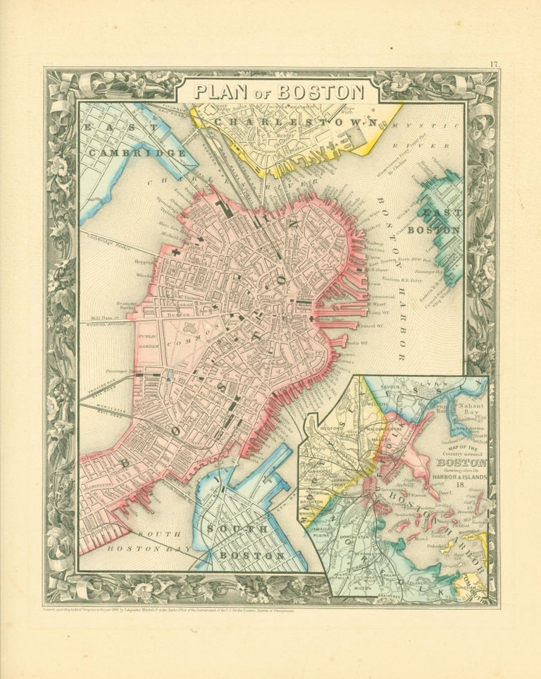
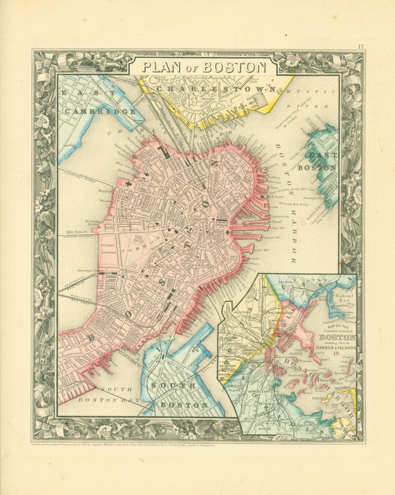
Plan of Boston (1860 map)
S. Augustus Mitchell, 1860. Map. Item #274105
ISBN: 281AIB1053718
Map, 11 x 9.25 inches, on sheet 15.5 x 13 inches. Printed in black on tan paper, hand-colored in red, yellow and blue. Map includes the wards and surrounding towns and neighborhoods distinguished by color. Inset map of Boston harbor. Map surrounded by floral border. Map is near fine. Sheet has some tanning to edges.
Price: $160.00
See all items in
Prints & Artwork
See all items by S. Augustus Mitchell