

Blair County, Pennsylvania. (1853 Land Surveys)
1853. Ephemera. Item #264632
ISBN: 281AIB1049135
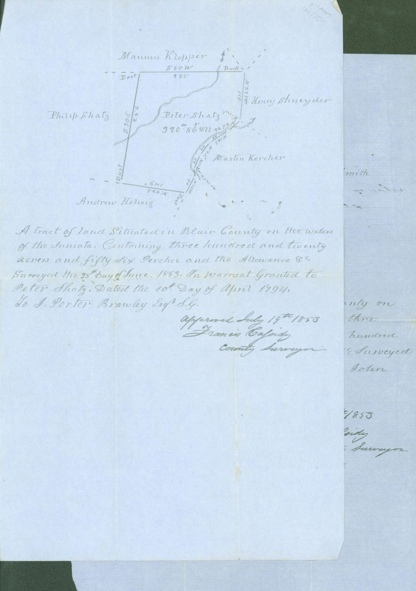
2 blue paper sheets, 12.75 x 8 inches, surveys completed by G. I. Porter, approved by Francis Cassidy, county surveyor, Blair Co., Pennsylvania. Near fine holograph land surveys, folded. 1. A tract of land situated in Blair County on the head waters of the Juniata containing three hundred and seventy eight acres and one hundred and thirteen perches and the allowance of surveyed. The 27th June, 1853. On warrant granted to John Moyer. Dated the 10th day of April 1794. J. Porter Brawley, Esq. Approved July 19th 1853 Francis Cassidy County Surveyor. 2. A tract of land situated in Blair County on the water of the Juniata. Containing three hundred and twenty acres and fifty-six perches and the allowance of surveyed the 25th day of June 1853. On warrant granted to Peter Shatz, Dated the 10th day of April 1794. J. Porter Brawley, Esq. Approved July 19th, 1853 Francis Cassidy county surveyor. Each page provides a map of the plot surveyed with neighboring tracts and owners identified.
Price: $60.00