
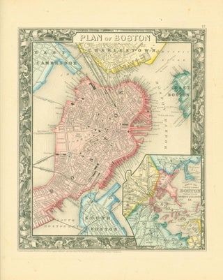
Plan of Boston (1860 map)
S. Augustus Mitchell, 1860. Map. Map, 11 x 9.25 inches, on sheet 15.5 x 13 inches. Printed in black on tan paper, hand-colored in red, yellow and blue. Map includes the wards and surrounding towns and neighborhoods distinguished by color. Inset map of Boston harbor. Map surrounded by floral border.....